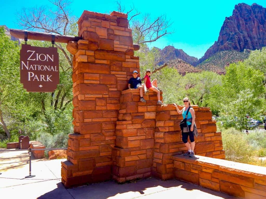
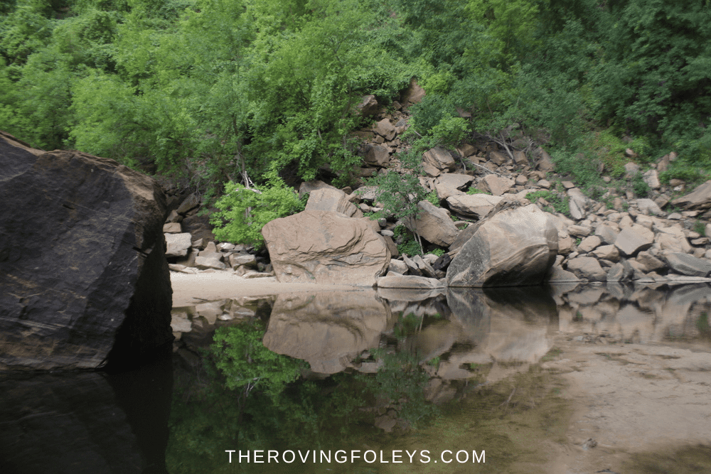
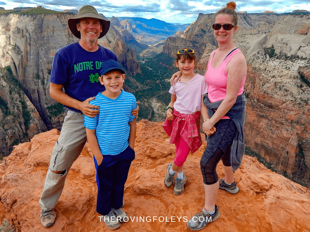
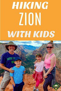
Zion National Park is one of the most breathtaking places on earth. Hiking at Zion National Park is the perfect way to experience all that the park has to offer, from the towering canyon walls to the diverse array of plants and animals. You can find a trail to fit any level of hiker, from easy day hikes to multi-day backpacking expeditions. Zion is a place where you can truly reconnect with nature and escape the hustle and bustle of everyday life.
Accessing Zion Canyon
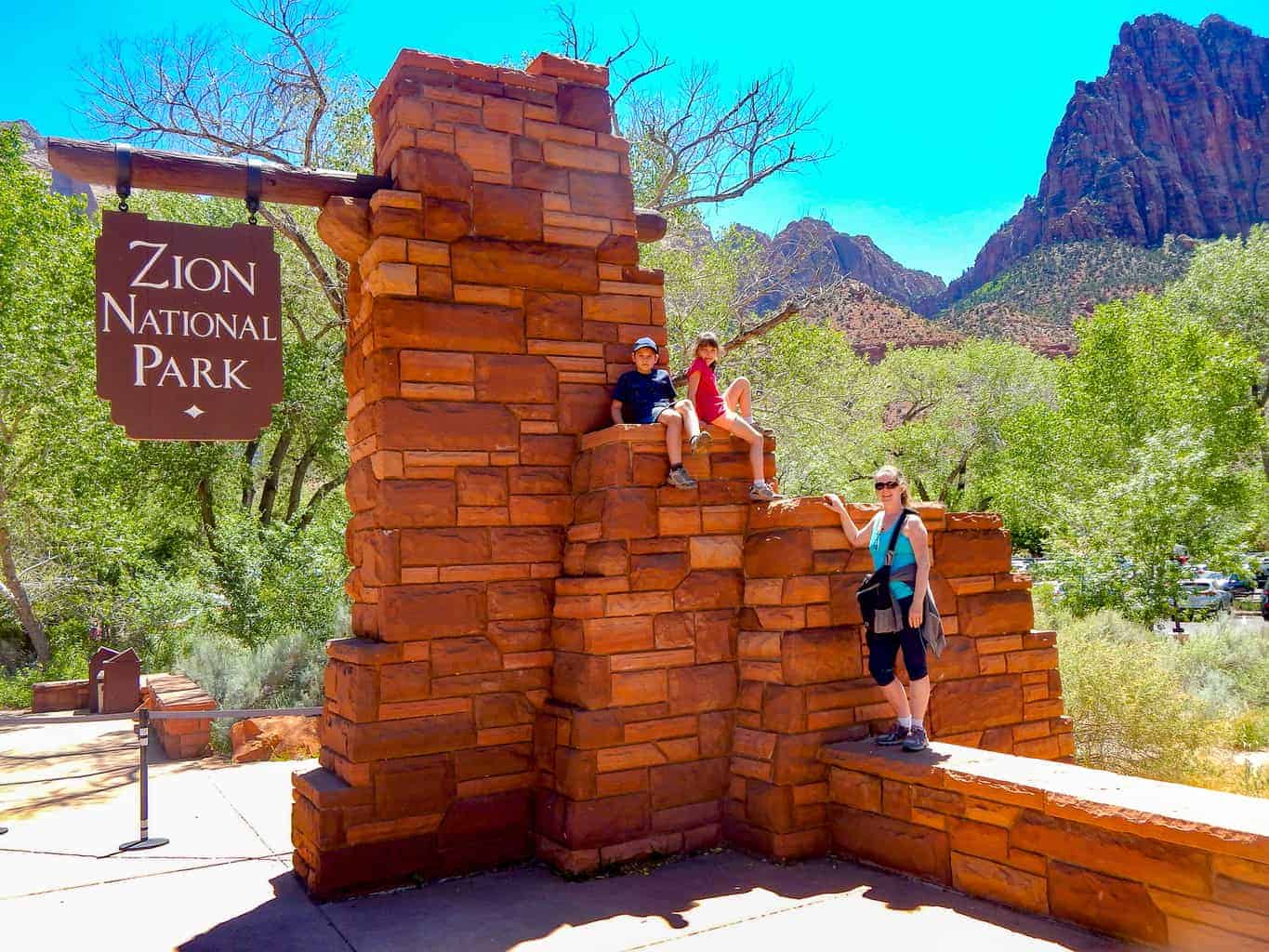
Zion Canyon is a true canyon. It is wider and open at one end (at Springdale) and gets narrower the farther you go in until it turns into a winding slot canyon (The Narrows) There is only one road deep into the canyon and therefore, auto traffic must be limited. Automobiles are only allowed as far as the Canyon Junction when the Zion Canyon Shuttle system is running (which is most of the year.) Canyon Junction is where the main canyon road meets the Zion-Mt.Carmel Highway.
Shuttles are easily accessible and run regularly from the Visitors Center, Museum, or Canyon Junction. They continue all along the Zion Canyon Scenic Drive making stops at all of the popular spots and trailheads. Parking can be limited at very busy times so get there early.
Other parts of the park, Kolob Terrace, Kolob Canyon, and the Zion-Mt Carmel Highway (upper east canyon) are open to vehicle traffic.
Permits May Be Required
Most overnight backpacking adventures in Zion require a permit. Many of the more strenuous and remote trails also require permits. Please check with the park office before undertaking any back country adventures.
Table of Contents
Easy Walking Trails
Lower Emerald Pool Trail
Trailhead Location: Across the road from the Zion Lodge.
Distance (roundtrip): 1.2 mi / 1.9 km
Elevation Change: 69 ft / 21 m
Estimated Hiking Time: 1 hour
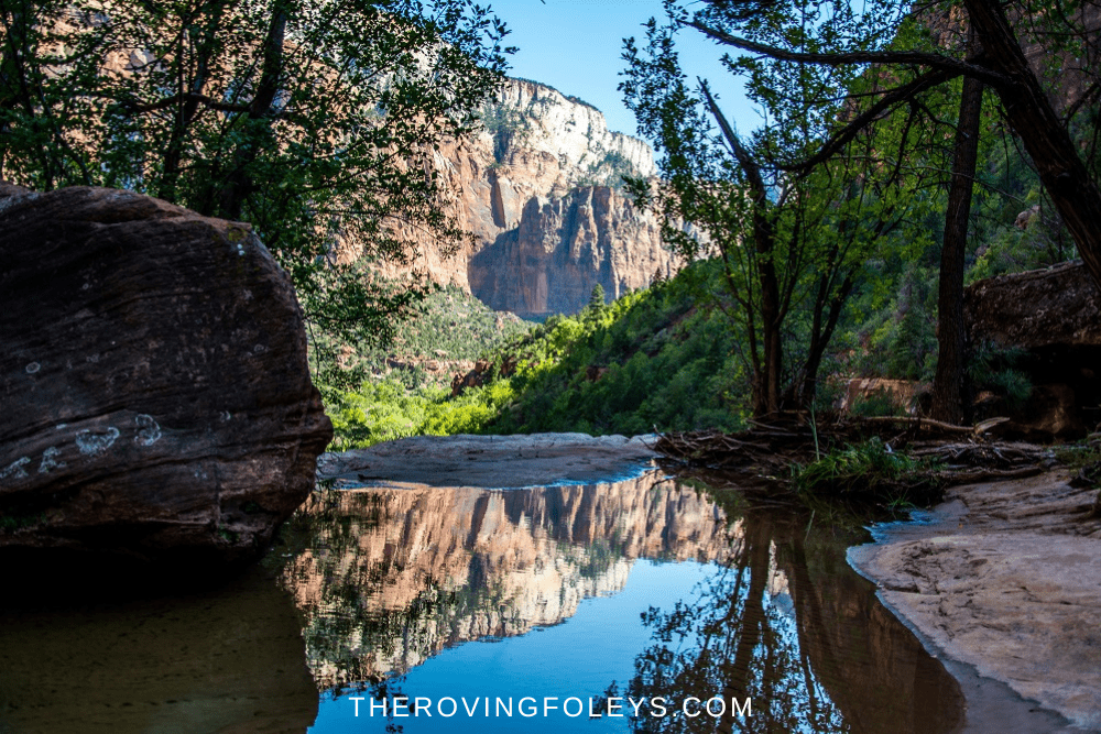
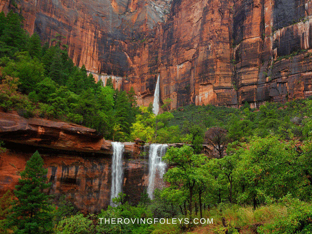
The Emerald Pool Trail is one of the most popular trails in Zion National Park. The trail is short and relatively easy, making it a great option for families or those looking for an easy hike with incredible views. The trail leads to three different pools, each with its own unique characteristics. The lower pool is the largest and has a small waterfall that flows into it.
The middle pool is emerald green in color, hence its name. The upper pool is the smallest of the three and is surrounded by cliffs. All three pools are fed by waterfalls and offer stunning views of Zion Canyon.
Pa’rus Trail
Trailhead Location: Up canyon from the Visitor Center and across the bridge adjacent to the South Campground. This trail can also be accessed from the Canyon Junction shuttle stop.
Distance (roundtrip): 3.5 mi / 5.6 km
Elevation Change: 50 ft / 15 m
Estimated Hiking Time: 2 hours
The Pa’rus Trail is a paved, easy trail that follows the Virgin River through Zion Canyon. The trail is popular with families and those who are looking for an easy hike with beautiful views. It is the only trail in Zion that allows dogs and bikes. The trailhead is located near the Visitor Center and South Campground.
From here, the trail meanders along the river before ending at the Canyon Junction shuttle stop.
Weeping Rock (Currently Closed)
Trailhead Location: Across the bridge adjacent to the parking lot. Follow the signs to the left.
Distance (roundtrip): 0.4 mi / 0.6 km
Elevation Change: 98 ft / 30 m
Estimated Hiking Time: 30 minutes
The Weeping Rock Trail is a short, easy trail that leads to the iconic Weeping Rock. The rock is a huge sandstone formation that has water seeping out of it, hence its name. The trail is located across the bridge from the main parking area.
From here, it winds its way through a canyon before ending at the base of Weeping Rock. It is also the traditional way to get to some of Zions other awesome places like Echo Canyon and Observation Point.
*CLOSURE: The Weeping Trail is currently closed due to rock slides. There is no current plan for it to re-open as the area is still not considered stable.
Grotto Trail
Trailhead Location: Behind the shuttle stop at the Zion Lodge. This trail can also be accessed from the Grotto if you walk down canyon and behind the historic stone building.
Distance (roundtrip): 1 mi / 1.6 km
Elevation Change: 35 ft / 11 m
Estimated Hiking Time: 30 minutes – 1 hour
While there is parking and a shuttle stop at the Grotto, sometimes that parking is full so you can walk in from the Lodge. The Grotto Trail is a short, easy trail that follows the Virgin River through Zion Canyon. The Grotto is an old campground that has been converted into a picnic area.
The trailhead is located behind the Zion Lodge shuttle stop. From here, the trail meanders along the river before ending at the Grotto, a popular swimming spot in the river. Along the way, you’ll have stunning views of the canyon walls and the river. You may even see some wildlife, such as deer, squirrels, and birds.
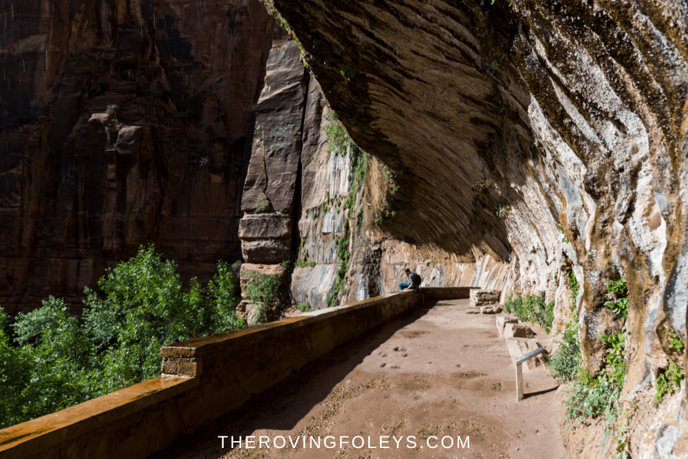
Riverside Walk
Trailhead Location: Adjacent to restrooms and water refill station.
Distance (roundtrip): 2.2 mi / 3.5 km
Elevation Change: 57 ft / 17 m
Estimated Hiking Time: 1.5 hours
Otherwise known as the Gateway to the Narrows, The Riverside Walk is a short out and back hike along an easy paved trail that follows the Virgin River through from the Temple of Sinawava (last shuttle stop) to the entrance to The Narrows. The trailhead is located adjacent to the restrooms and water refill station. From here, the trail meanders along the river before ending at the Narrows entrance.
You can access this walk by exiting the Zion shuttle at the last stop.
Archeology Trail
Trailhead Location: Behind the Zion Canyon Visitor Center near the entrance to the Visitor Center parking lot.
Distance (roundtrip): 0.4 mi / 0.6 km
Elevation Change: 80 ft / 24 m
Estimated Hiking Time: 30 minutes
The Archeology Trail is a short, but kind of steep trail that leads to the top of a small hill. The trail is located behind the Zion Canyon Visitor Center near the entrance to the Visitor Center parking lot. From here, it winds its way through a canyon before ending at the top of the hill. Along the way, you’ll have stunning views of the canyon walls and the Virgin River. There are trailside exhibits along the way to stop and ponder.
Moderate Hikes In Zion Canyon
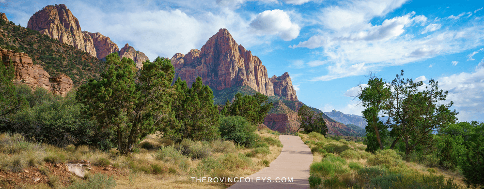
Watchman Trail
Trailhead Location: Up canyon and across the road. Stay along the river to begin the trail.
Distance (roundtrip): 3.3 mi / 5.3 km
Elevation Change: 368 ft / 112 m
Estimated Hiking Time: 2 hours
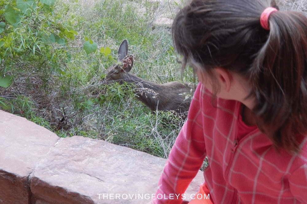
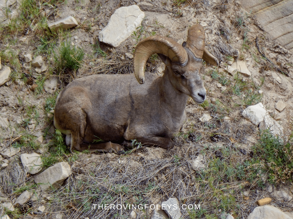
The Watchman Trail is a moderate trail that climbs several hundred feet in elevation to the Watchman Overlook. The trailhead is located across the road from the Visitor Center. From here, it winds its way through a canyon before ending at the first level of cliffs. There is a small loop here for views all around. There are amazing views of The Watchman mountain along the trail. Watch for deer and other wildlife.
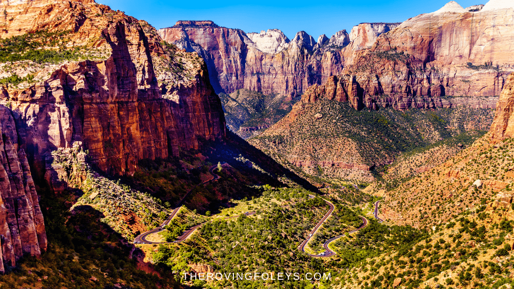
Canyon Overlook Trail
Trailhead Location: East of the Zion-Mt. Carmel tunnel, just off RTE 9
Distance (roundtrip): 1.0 mi
Elevation Change: 187 ft
Estimated Hiking Time: 30 minutes – 1 hour
The Canyon Overlook Trail is a moderate trail that leads to stunning views of Zion Canyon. It is not particularly difficult, but does have some handrail sections over 1000ft drops, so do exercise caution. This trail is very popular so go early to get a parking spot. Be sure to stop at the various overlooks to take in the views of Bridge Mountain, East Temple and if you look closely, the tunnel “windows.”
Middle Emerald Pools Trail
Trailhead Location: Across the street from Zion Lodge and then across the footbridge.
Distance (roundtrip): 2.2 mi / 3.5 km
Elevation Change: 150 ft / 46 m
Estimated Hiking Time: 1.5 hours
The Middle Emerald Pools Trail is a moderate trail that leads on from the lower pools. It becomes slightly more strenuous as you ascend the cliffs you were previously under. This is a very pretty portion of the Emerald Pools “trilogy.” Please stay out of the water- there is NO swimming in any of the pools.
Kayenta Trail
Trailhead Location: Across the street from the Grotto shuttle stop and then across the footbridge.
Distance (roundtrip): 2.0 mi / 3.2 km
Elevation Change: 150 ft / 46 m
Estimated Hiking Time: 1.5 hours
The Kayenta Trail is a moderate trail that leads from the Grotto shuttle stop to the Emerald Pools. It is an important little stretch of trail because it links together several of Zions most popular hikes. On one side, it links the Grotto and Emerald pools together, and in turn links both to the West Rim Trail and then Angels Landing.
It is a very pretty trail with great views of the canyon. Along the way, you’ll pass through a section of Navajo Sandstone that has been eroded into interesting shapes. Please stay on the trail to protect the delicate plants that grow here.
Upper Emerald Pool Trail
Trailhead Location: Starts from the end of the Kayenta Trail, or from the Middle Emerald Pools.
Distance (roundtrip): 1.0 mi / 1.6 km
Elevation Change: 200 ft / 61 m
Estimated Hiking Time: 1 hour
The Upper Emerald Pool Trail is a moderate trail that leads to the upper Emerald Pool. It is the third and final step in the Emerald Pools “trilogy.” The trail becomes steep in places as it climbs up to the upper pool. There are amazing views of the canyon from here. Please stay out of the water- there is NO swimming.
This trail can be accessed from either the Lower/Middle pools, OR by taking the Kayenta Trail from the Grotto. For a nice 3 mile loop, start at the Lodge, take the Emerald Pools Trail all the way up to the Upper Pool, and then on the way back down, take the Kayetna Trail to the Grotto, and the Grotto Trail back to the Lodge. Awesome hike!
Strenuous Hikes
Hidden Canyon Trail (Closed for the foreseeable future)
Trailhead Location: Access the East Rim Trail from across the footbridge adjacent to the parking lot. The Hidden Canyon Trail turns right from the East Rim Trail at the sign.
Distance (roundtrip): 2.5 mi / 4.0 km
Elevation Change: 850 ft / 259 m
Estimated Hiking Time: 2.5 hours
This strenuous hike features 850 feet of elevation gain and a number of challenging sections, but it is well worth the effort. The trail takes hikers through a narrow canyon with towering walls on either side. In places, the canyon walls are so close together that hikers must scramble up rocks to continue. The views from the top are simply stunning, and hikers are rewarded with a sense of accomplishment that comes from tackling such a difficult trail. If you’re looking for an adventure, the Hidden Canyon Trail is definitely worth checking out.
All of this is wonderful EXCEPT that the path to Hidden Canyon runs through the Weeping Rock Trail which was destroyed in a massive rock slide a few years ago. There is no news as to when or if that area will be reopened.
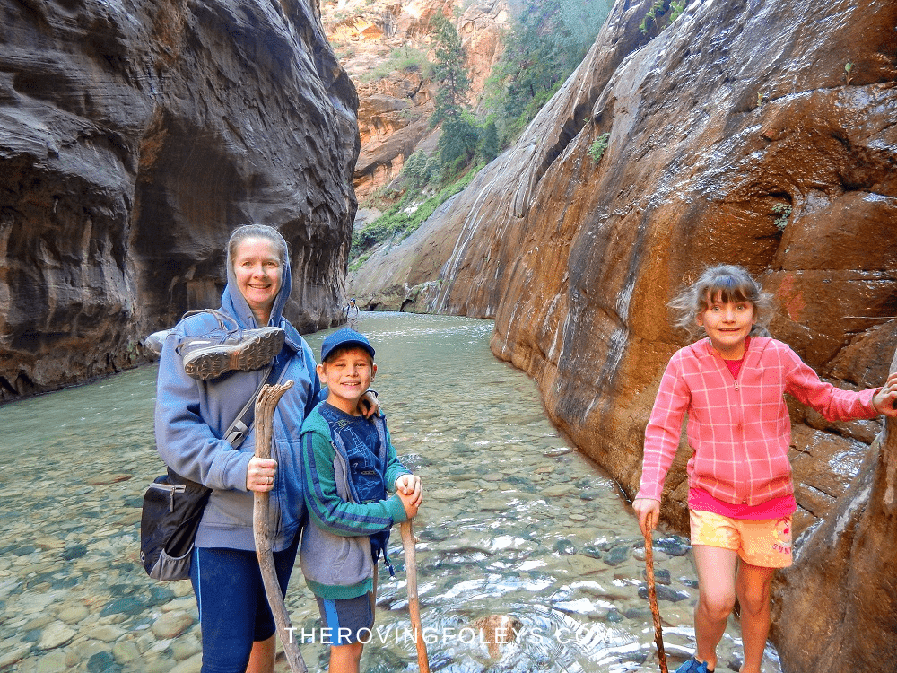
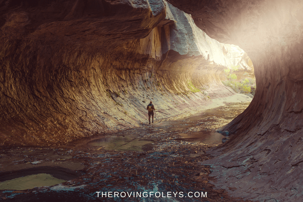
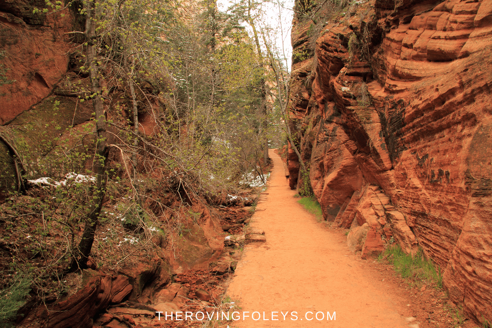
The Narrows (Bottom Up via River Walk Trail)
Trailhead Location: End of the Riverwalk Trail, last shuttle stop
Distance (roundtrip): up to 9.4 mi / 15.1 km
Elevation Change: 334 ft / 102 m
Estimated Hiking Time: up to 8 hours
The Narrows is one of the most popular hikes in Zion National Park, and it’s easy to see why. The trail follows the Virgin River through a narrow canyon with towering walls of red rock. The scenery is truly breathtaking, and the hike can be as easy or challenging as you make it. Depending on the time of year, the river can be either knee-deep or waist-deep, so be sure to bring appropriate footwear.
The trip into The Narrows starts with several water crossings until the land part finally subsides and there is only water- and it is COLD! We brought some walking sticks with us, people leave sticks leaning up against the wall so everyone can have a turn. You will need sticks otherwise you could hurt yourself walking through the stones.
The Narrows is also one of the busiest trails in the park, so it’s important to start early to get a spot. The problem with hitting this trail early is that the sun is not into the canyon yet and it tends to be a bit cold, so hiking in freezing mountain water does not help.
You can dry suits, boots etc. in town to help. Whether you’re an experienced hiker or a first-timer, the Narrows is definitely worth a visit. Starting at the bottom, you can delve in as deeply as you wish, then just turn around and head back.
*Permit Required for longer adventures on this trail (past Big Springs.) Casual day hikes do not require a permit.
The Narrows (Top Down via Chamberlain Ranch)
Trailhead Location: Chamberlain Ranch
Distance (roundtrip): 15.5 miles
Elevation Change: 1017 ft
Estimated Hiking Time: up to 8 hours
*Permit Required for this trail
The Narrows is a dramatic gorge that has been carved over time by the Virgin River. Hiking through the Narrows is an unforgettable experience, and visitors can choose from a variety of routes depending on their level of expertise. For those looking for a challenge, the Zion Narrows Top-Down hike is a 16-mile round trip that starts at the top of the canyon and descends into the river.
The trail is strenuous, but hikers are rewarded with incredible views of sheer cliffs, winding canyons, and cascading waterfalls. No matter which trail you choose, hiking through the Narrows is an unforgettable way to experience Zion National Park.
White Knuckle Hikes
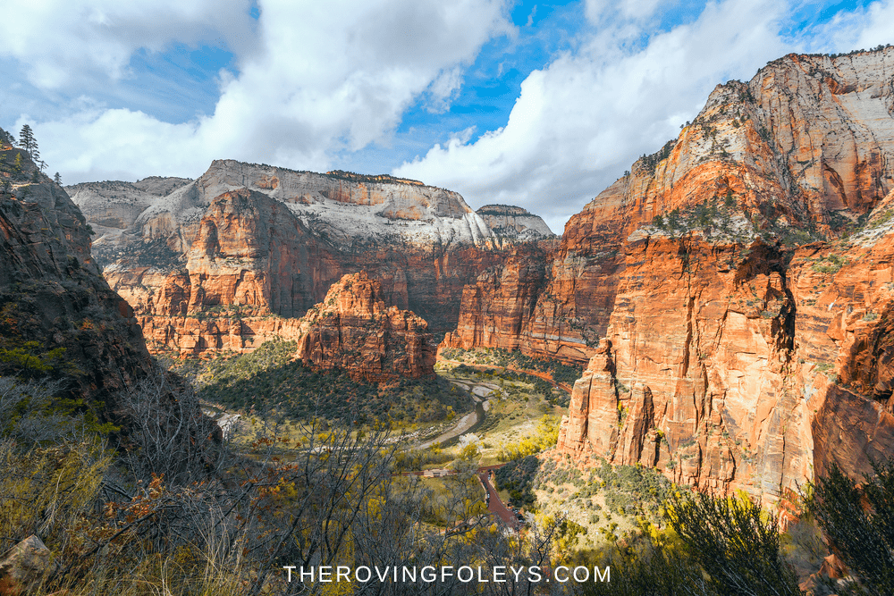
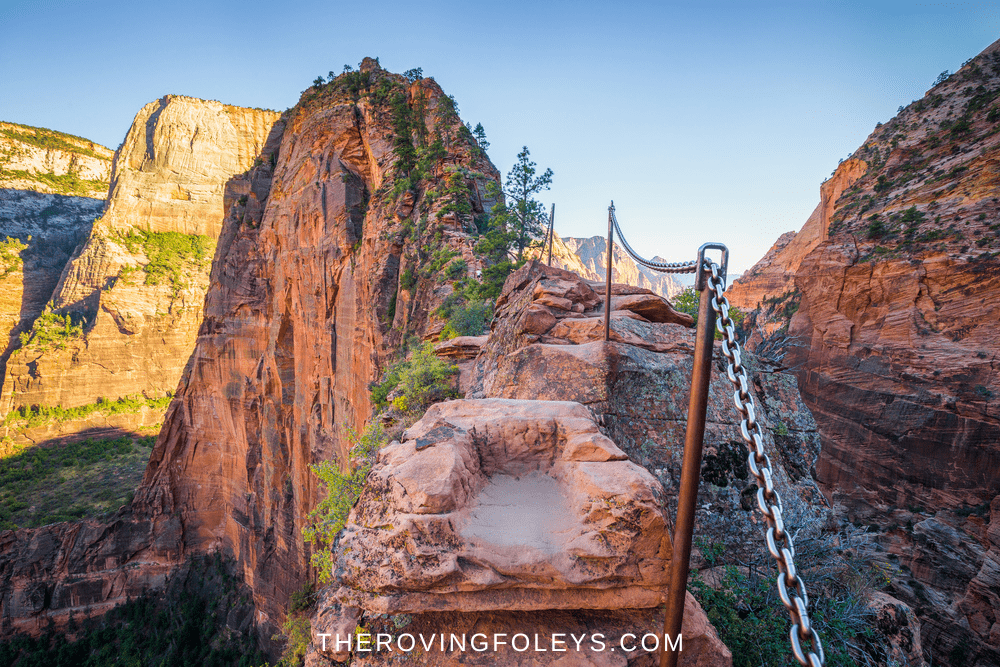
Angels Landing (via West Rim Trail)
Trailhead Location: Across the road from the Grotto shuttle stop and then across the footbridge.
Distance (roundtrip): 5.4 mi / 8.7 km
Elevation Change: 1,488 ft / 453 m
Estimated Hiking Time: 4 hours
Angels Landing is unquestionably the most famous of the Zion National Park hikes. It is also considered by many to be the most dangerous hike in the USA. The trailhead is located at the Grotto Picnic Area, and the hike itself is just over five miles round trip. Angels Landing gets its name from a large fins of rock that protrude from the side of the mountain, creating the appearance of wings.
The last half-mile of the hike is also the most strenuous, as hikers must navigate a series of switchbacks known as Walter’s Wiggles. At the top of Angels Landing, hikers are rewarded with stunning views of Zion Canyon. Despite its challenges, Angels Landing is considered to be a moderate hike, and it can be completed by people of all ages and abilities.
*Permit Required for this trail. of
Observation Point
Trailhead Location: Access the East Rim Trail from across the footbridge adjacent to the parking lot. The Observation Point Trail branches off of the East Rim Trail after approximately 2.5 miles.
Distance (roundtrip): 8.0 mi / 12.9 km
Elevation Change: 2,148 ft / 655 m
Estimated Hiking Time: 6 hours
Observation Point is without a doubt one of the most awe inspiring spots in Zion. From the top, you can see nearly the entire length of the Zion canyon, including looking down at the top of Angels Landing! While it has traditionally been accessed from the Weeping Rock Trail within the park, that area has been closed for several years due to massive rock falls.
However, there are still ways to get there. The East Rim Trail which starts just inside the east entrance does get you there, and you will get to enjoy some of the cliff edge inclines that make Observation Point a hike for the adventurer. The East Mesa trail which is shorter, requires some driving on weather questionable roads.
However for those who want to visit Observation Point without the fear inducing cliffs, this is the route. There is shuttle service from Springdale as well if you would rather just take a lift. If you go to Zion- do everything you can to make this a part of your trip. We thought it was among the best hikes in Zion.
East Rim Trail
Trailhead Location: Just inside the East Entrance to the park.
Distance (roundtrip): 9.9 miles
Elevation Change: 1354 ft
Estimated Hiking Time: 4-6 hours
The East Rim Trail in Zion National Park is a popular hiking trail that offers breathtaking views of the park’s canyons and mountains. It has been made much moreso now that it is one of the only ways to Observation Point.
The trail is approximately 9 miles long and features a number of exposed, so it is recommended to use caution. However, the effort is well worth it, as the trail provides access to some of the most incredible scenery in Zion National Park. It is one of the most scenic of Zion hikes.
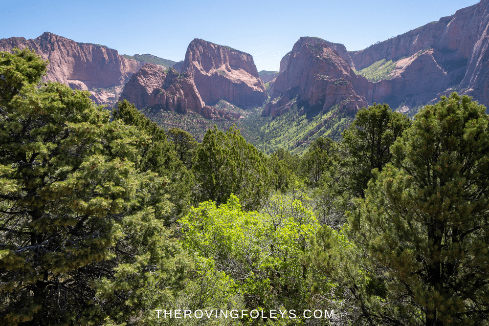
Kolob Canyon/ Terrace Hikes
The Subway
Trailhead Location: Left Fork Trailhead 8.2 miles from Virgin up the Kolob Terrace Road
Distance (roundtrip): 8 miles out and back
Elevation Change: 600 ft
Estimated Hiking Time: 5-10 hours hours roundtrip
This is considered the “from the bottom” route which is more of a hike than the “top down” version which is more of a canyoneering adventure. The Subway, a slot canyon with walls that are almost vertically sheer. They come so close together that a “tube has been cut out at the bottom forming the “subway”
The only way to reach the Subway is by hiking, and the trip can take up to 10 hours. However, it is well worth the effort, as the Subway is one of the most beautiful and secluded places in Zion National Park. When you finally reach the end of the trail and stand at the edge of the canyon, you will be rewarded with a breathtaking view that will stay with you for a lifetime.
*Permit Required for this trail
Timber Creek Overlook
Trailhead Location: Kolob Canyons Viewpoint parking lot at the end of the Kolob Canyons Road
Distance (roundtrip): 1.0 miles / 1.6 km
Elevation Change: 100 feet / 30 m
Estimated Hiking Time: 0.5 hours roundtrip
Hiking the Timber Creek Overlook Trail is an amazing experience for anyone who loves to take in scenic views and enjoy nature. This trail provides visitors with some of Utah’s most impressive scenery, including its stunning desert wildflowers that come alive during springtime or early summer months (when they’re visible at their best).
You’ll be hard-pressed not find yourself lost in thought while walking along this path leading up to views of Kolob Canyons, the Kolob Terrace, and Shuntavi Butte. Even gazing south toward Grand Canyon North Rim; 100 miles away!
Northgate Peaks Trail
Trailhead Location: Wildcat Canyon Trailhead parking 15.5 miles from Virgin up the Kolob Terrace Road
Distance (roundtrip): 6.0 miles
Elevation Change: 1118 ft
Estimated Hiking Time: 3-4 hours roundtrip
The Northgate Peaks Trail is a fairly easy hike to see some of the lesser known scenery of the park. The trail is accessed by taking the Wildcat Valley trail about a mile or so from the trailhead toward Lava Point. Then it will intersect with the Northgate Peaks Trail. Another mile or so and you will come to the viewing area for the Peaks- the Great West Canyon. The East and West Northgate Peaks are clearly visible, with the North Guardian Angel right in between. Awesome!
Hop Valley Trail
Trailhead Location: Hop Valley Trailhead off the Kolob Terrace Road
Distance (roundtrip): 14.3 miles
Elevation Change: 1791 ft
Estimated Hiking Time: 6-8 hours roundtrip
The Hop Valley Trail is a fairly leisurely 6.5 miles which transitions from the Kolob Terrace to the Kolob Canyons sections of the park. It is part of the “Trans Zion Hike” which connect the Kolob Canyon area to the main Zion Valley. Much of the start of the trail runs through cattle grazing country so mind the deposits which have earned the nickname “Plop Valley.”
Once you descend into Hop Valley the scenery becomes quite beautiful with walls rising on both sides and gorgeous colors all around. At the end, the trail descends quickly down to the LaVerkin Creek. A short walk up the creek to the west leads to the Kolob Arch spur trail.
LaVerkin Creek Trail
Trailhead Location: Lee Pass Trailhead on the Kolob Canyons Road
Distance (roundtrip): 14.0 miles / 22.5 km
Elevation Change: 1,037 feet / 316 m
Estimated Hiking Time: 8 hours roundtrip
Hikers will find that the La Verkin Creek Trail offers them outstanding opportunities for solitude in a primitive area of Zion Wilderness. The trail begins at Lee Pass with stunning views across Kolob Canyons and continues down into the LaVerkin Creek.
After seven miles on foot there is a spur trail leading to ‘Kolob Arch’–a span measuring 287 feet tall made out massive rock formations. It is one of the largest arches in the world.
Taylor Creek Trail
Trailhead Location: Taylor Creek Trailhead on the Kolob Canyons Road
Distance (roundtrip): 5.0 miles / 8.0 km
Elevation Change: 450 feet / 137 m
Estimated Hiking Time: 3-4 hours roundtrip
Hikers will be fascinated by the network of canyons on this hike that lead them deep into a narrow box canyon. They will pass a natural fold in the earths crust called Kanarraville Fold, and pass two 1930’s ear log cabins before finally coming to the Double Arch Alcove.
Wildcat Canyon
Trailhead Location: Taylor Creek Trailhead on the Kolob Canyons Road
Distance (roundtrip): 11.3 miles
Elevation Change: 1295 ft
Estimated Hiking Time: 4-6 hours roundtrip
Wildcat Canyon Trail is another section of the Trans-Zion Trek, which allows hikers to traverse the entire park from Kolob Canyon all the way to the main valley. This particular section runs from the bottom of Hop Valley along the Wildcat Canyon, to the West Rim Trail near Lava point.
While there is no particular destination on this trail, it does link up to some of the amazing features in this section of the park, like Northgate Peaks.
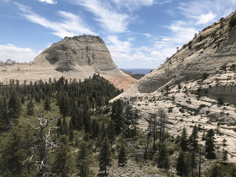
West Rim Trail (top down)
Trailhead Location: West Rim Trailhead at Lava Point on the Kolob Terrace Road
Distance (roundtrip): 19.0 miles / 30.6 km
Elevation Change: 1,500 feet / 450 m
Estimated Hiking Time: 9 hours
While most hikers on the West Rim Trail start at the Grotto, using it to get to Angels Landing, those who are hiking the entire 19 miles will usually start at the top- Lava Point. Hiking the Zion West Rim Trail is an unforgettable experience for anyone who loves scenic views and rugged terrain.
The 16-mile point to point trail begins at Horse Pasture Plateau before descending into one of America’s most iconic red canyons, exploring vast stretches that range from Ponderosas forests to sagebrush steppe on its way down past the Angel’s Landing Trail and then on to The Grotto.
Whether you are looking for an easy day hike or a challenging backpacking trip, Zion National Park has a trail for you. The park is home to some of the most incredible views in the world, and hiking is the perfect way to experience them. So, when you visit Zion National Park, lace up your boots and hit the trails – you won’t be disappointed!
Did we miss anything, is there a hike you would recommend we should have done with the kids?

Grainne Foley
Grainne Foley grew up in Ireland and spent summers caravanning around Europe with her family. Now, as a wife and mother of 2, she spent 5 years traveling the USA as a full time RVing family. She is passionate about travel, and helping others who are considering the RV lifestyle. She has created dozens of helpful RVing checklists which are available throughout the website, and has curated hundreds of simple, flavorful meals for families on the go.
What month were you there? We want to go and were thinking of going in May, but we don’t really like crowds. I’m wondering what month is still warm-ish but not too crowded. Thanks!
We were also there in May. The weather was great, but traffic is already pretty high. By the numbers Zion receives 11-13% of its annual traffic every month between April and September. This makes March and October the better months as far as traffic goes. Of course then there is the weather which would be more of a question. April would probably be better than May as it starts more slowly and builds up- and the weather is still pretty nice. May was not terrible for us- just trying to get on the buses in the morning, and some crowds on some of the trails. Hope that helps.
Yes. Thank you! We live right beside Disney World and are SO SICK of crowds. We want to go somewhere and not deal with people and lines. Your tips are great. Thanks!
I feel your pain. Our old life was in South Florida, so Disney World was the go-to. CROWDS! National Parks are fantastic- especially the ones that are less traveled.
Pingback: Family Camping Checklist: (Free Printable) - The Roving Foley's
Pingback: Ultimate Guide to Great Smoky Mountains Hiking Trails (By Difficulty) - The Roving Foley's